5 1.5 HOW DO I DESCRIBE WHERE I AM?
Defining a location by using the geographic grid is only part of the process of describing a place. Geographers are primarily concerned with two ways of describing a place: site and situation. Site refers to the physical characteristics, such as the topography, vegetative cover, climatic conditions, and the like. Situation, on the other hand, refers to the area surrounding the place, and is sometimes referred to as relative location. In other words, where is this place relative to other places, and how is it connected to its surroundings via transportation networks? New Orleans provides an excellent example of site versus situation. The site of New Orleans is not ideal for a city, as it lies below sea level and is prone to flooding. However, the situation of New Orleans is much better in that New Orleans is connected to large portion of the Mississippi River’s network of navigable waterways while also being close to the Gulf of Mexico and convenient to coastal traffic. Hence, the situation of New Orleans is why the city has not long since been abandoned, despite catastrophic flooding such as during Hurricane Katrina in 2005. As we examine various places around the world, both site and situation are key considerations in determining the “why” of where a place is located.
1.5.1 Regions
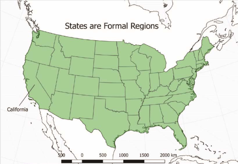
While site and situation can help describe a place, a broader view of the world and the connections between places can be derived from the concept of regions. A region is an area that shares some sort of common characteristic that binds the area into a whole. Geographers use regions to help one understand the interconnections between places and simplify a complex world. Two major types of regions are formal and functional. Formal regions are characterized by homogeneity or uniformity in one or a number of different characteristics. These characteristics can be both human and physical-related, so regions could be defined by climate or vegetation types, in the sense of physical geography, or they could be defined by language or ethnicity, in the sense of human geography. One example of a map that includes formal regions would be a map of the states in the US. In this map, each state could be considered a formal region because each state is governed in a common or unique way, and hence portrays homogeneity (Figure 1.6).

Figure 1.6 | United States
This map shows the formal regions of the states.Author | David Dorrell
Source | Original Work
License | CC BY SA 4.0
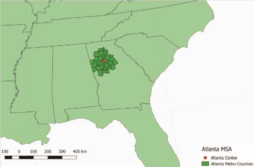
A functional region, which is sometimes called a nodal region, is an area that contains a central node or focal point to which other places in the region are connected by some activity. Functional regions can be seen in cities where the central area of the city might serve as the focal point for the rest of the metropolitan area (Figure 1.7). At a smaller scale, a Wi-Fi hotspot could be considered the focal point of a functional region that extends to the range of the Wi-Fi signal. Even the delivery area for the local pizza restaurant would be a functional region with the restaurant as a central node.

Figure 1.7 | Atlanta MSA
The Atlanta Metropolitan Statistical Area as defined by the United States Census Bureau.
Author | David Dorrell
Source | Original Work
License | CC BY SA 4.0

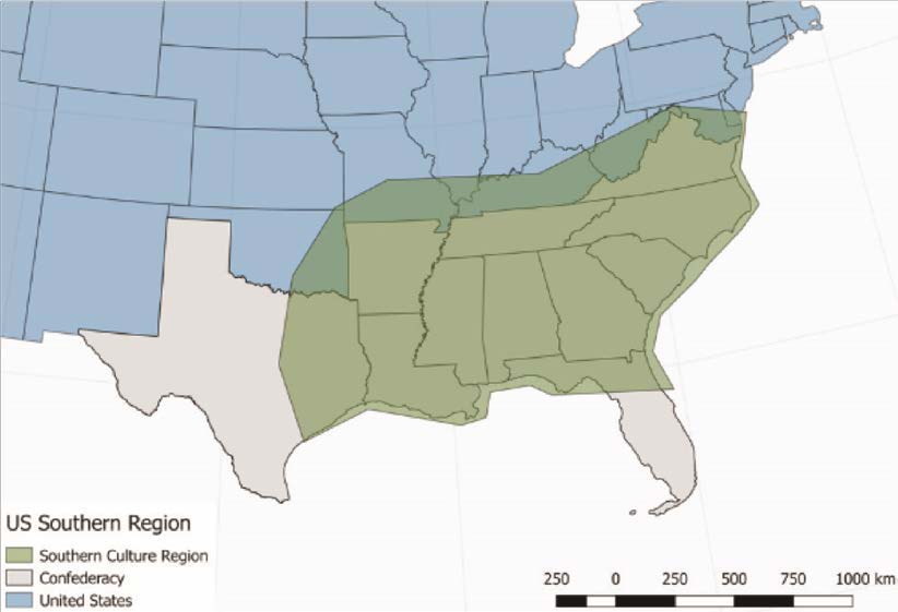
Figure 1.8 | The Fuzzy Boundaries of the American South
It’s not exactly the old Confederacy, or the slave states. And it varies from one part to the next.
Author | David Dorrell
Source | Original Work
License | CC BY SA 4.0
Regions are devised and not absolute, so whether or not a particular place fits within a region is sometimes a matter of dispute. For example, scholars disagree on the exact extent of the American South as a formal region. What defines this region? It depends on what characteristics one uses to define the region, be they food, dialect, political affiliation, historical affiliation in the Civil War, or any other element the mind conjures up when one thinks of the South as a relatively homogeneous formal region. Most geographers see Texas as a part of the South, but West Texas is much different from East Texas, and Florida is likewise diverse. Extreme southern Florida is vastly different from the panhandle of Florida in ethnic make-up and political affiliation. The opinion on what constitutes the Southern region varies based on personal viewpoints (Figure 1.8). The Southern region, then, may be thought of as a vernacular (or perceptual) region because the boundaries of these types of regions depend on the perspectives or mental maps of different groups of people who live both outside or inside that region. Hence, the concept of regions and their definition is not a straightforward process and involves generalities and varying opinions.
