4 1.4 WHERE IN THE WORLD AM I?
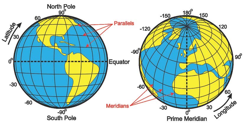
One of the most important pieces of information that maps provide is location. Knowing precisely where a place is in the world is fundamental to geography.While one can define a location simply by using a street address, not all places on Earth have such an address. Therefore, one of the basic ways to pinpoint a location on the Earth is using the geographic grid. The geographic grid is comprised of meridians and parallels, which are imaginary lines and arcs crisscrossing the Earth’s surface. Meridians are half circles that connect the north and south poles, and longitude refers to the numbering system for meridians. Parallels are circles that encompass the Earth and are parallel to the equator, and the numbering system for these circles is known as latitude (Figure 1.4). Where meridians and parallels intersect at precise locations (points) on the Earth on the geographic grid, a location can be known by its latitude and longitude.

Figure 1.4 | Longitude and Latitude
The geographic grid comprised of meridians and parallels with longitude and latitude.
Author | User “Djexplo” and Corey Parson
Source | Wikimedia Commons
License | CC 0
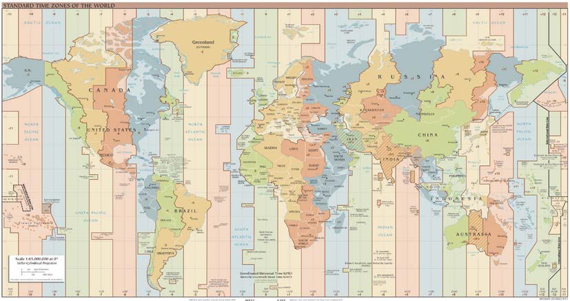
A few meridians on Earth are of particular importance, one being the Prime Meridian located at 0o longitude, which passes through Greenwich, England. The other important meridian, called the International Date Line, follows roughly along 180 o longitude, and this meridian is on the opposite side of the world from the Prime Meridian (Figure 1.5). When a traveler crosses the International Date Line, the day of the week instantaneously changes. When moving westward, the day moves forward, and when traveling eastward, the date jumps backward one day. Fortunately, the International Date Line is in the middle of the Pacific Ocean, so disruptions to the daily calendar are minimal for most people in the world. Moreover, the International Date Line does not precisely follow the 180 o longitude line, and this accommodation allows countries and territories consisting of islands that straddle 180 o longitude to share the same calendar date.

Figure 1.5 | Time Zones
This world map shows the international date line and global time zones.
Author | Central Intelligence Agency
Source | Wikimedia Commons
License | Public Domain
